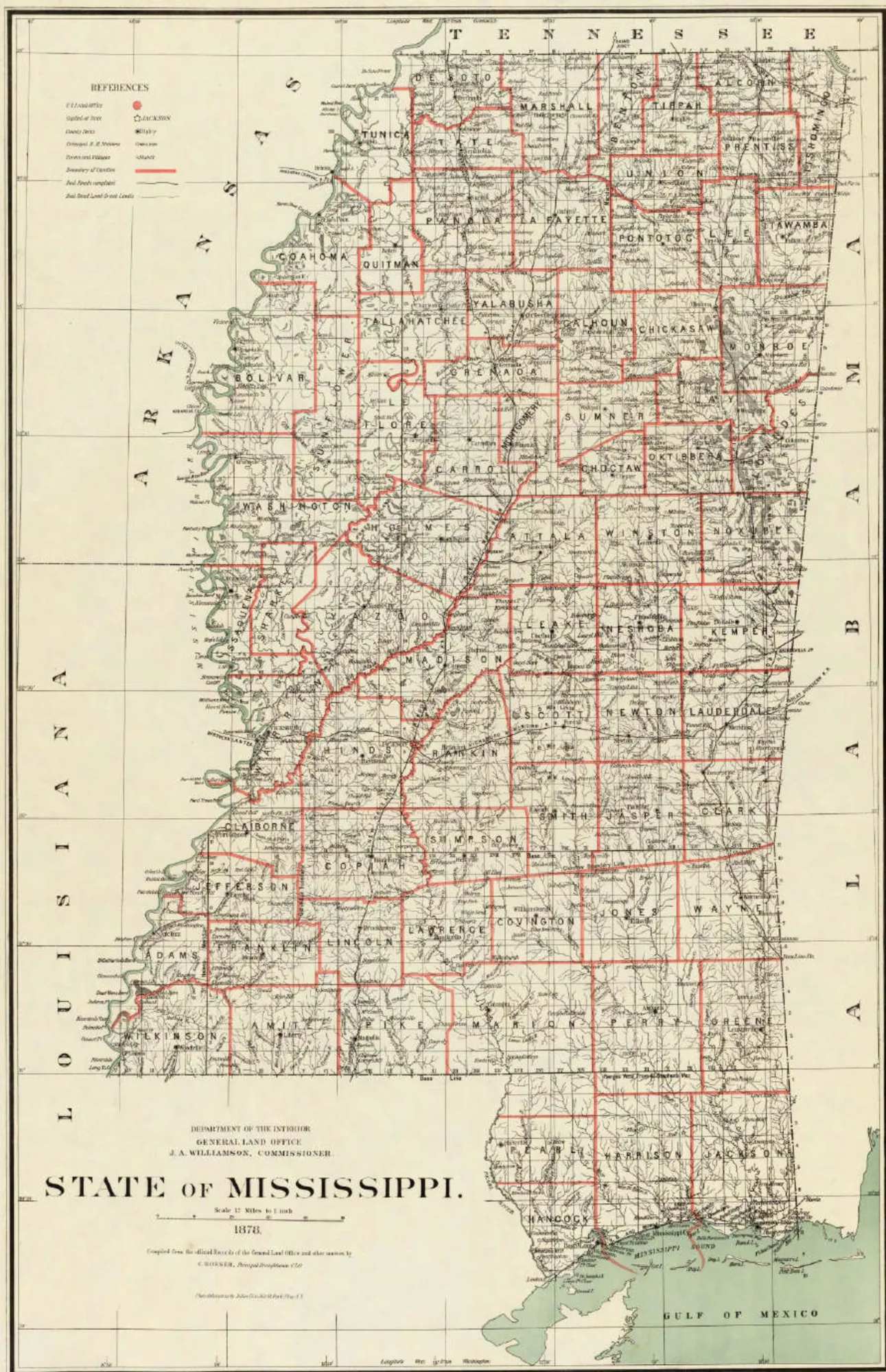
Look at a map of Mississippi and you see very different kinds of lines. The southwestern boundary is a parallel of latitude, drawn across the map without regard to anything on the ground. The eastern boundary is a straight line that kinks near the middle and then angles off to the northeast. The northern boundary is a surveyor's approximation of the 35th parallel that misses it. And the western boundary is a river that has never stopped moving, and that has produced more than a century of original-jurisdiction litigation in the Supreme Court of the United States.
This is the first of two articles. It covers how each line was drawn, from the first European claims to the 1837 survey of the Tennessee line. Part 2 covers the litigation that has defined the river and Gulf boundaries since.
Before the lines were drawn
The earliest European claims to what is now Mississippi were not really boundaries at all. They were assertions of dominion over indefinite interiors, made by men who did not know the extent of what they were claiming.
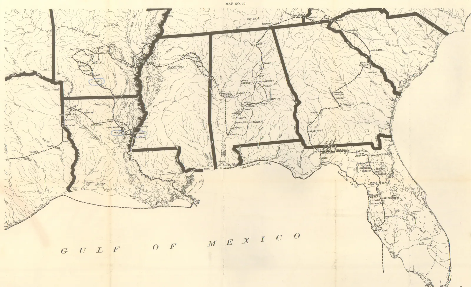
Spain was the first European nation to lay claim to territory in Mississippi. It did so by discovery and exploration—Hernando de Soto marched through Mississippi between 1540 and 1541—but Spain neither settled nor surveyed it, and after de Soto the crown concentrated its efforts on the Florida peninsula and its other possessions in the Americas.1
England was equally casual in its claim to Mississippi. In 1663, King Charles II granted Carolina's charter and later expanded it in 1665, running the colony's western boundary all the way to the Pacific and its southern boundary down to the 29th parallel. On paper, Carolina swallowed all of present Alabama and Mississippi.2 Like Spain, though, England neither settled nor surveyed any of it.
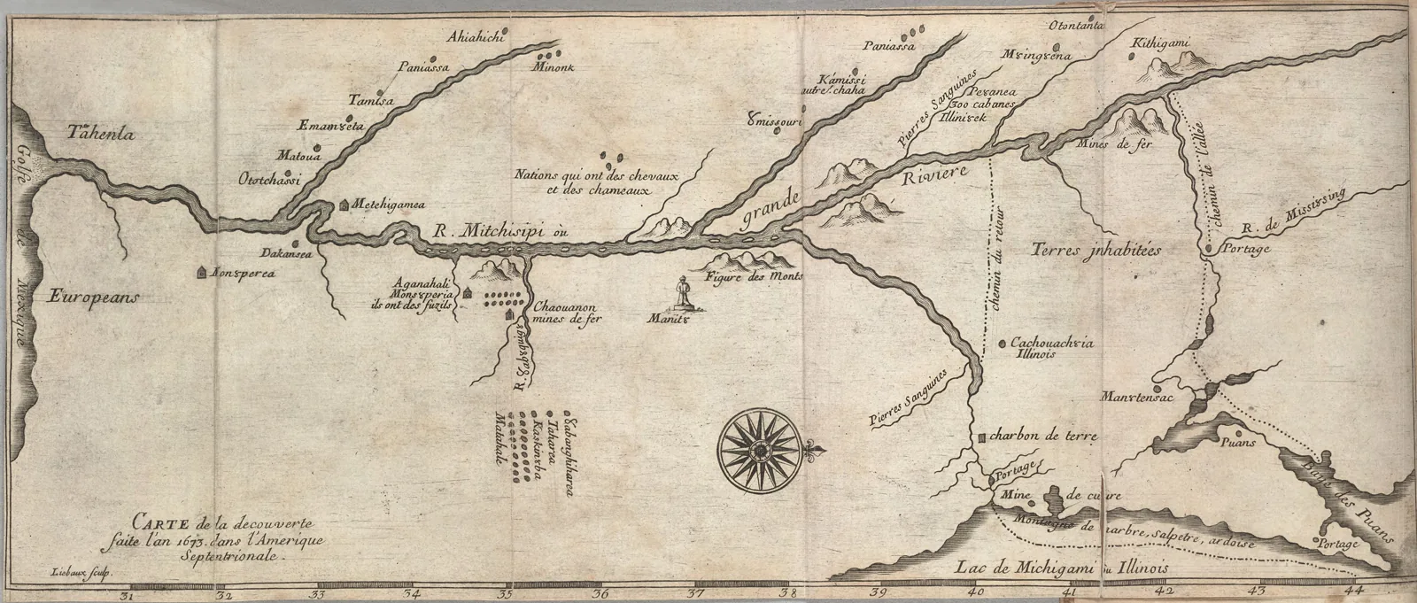
France was the European power that actually showed up on the ground. Jacques Marquette and Louis Joliet were the first Frenchmen to explore Mississippi. In 1673, the group traveled from Green Bay down the Wisconsin River and then down the Mississippi River until they reached the mouth of the Arkansas River. Satisfied that the Mississippi River emptied into the Gulf of Mexico, they decided to turn back, fearing capture or death by Spaniards or Native Americans.3
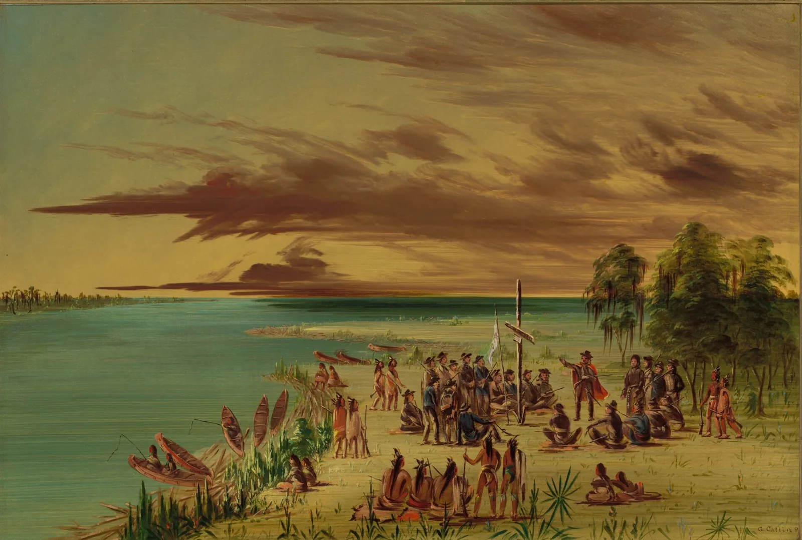
Later, in August 1681, René-Robert Cavelier, Sieur de La Salle, accompanied by Henri de Tonti, set out to become the first Europeans to reach the mouth of the Mississippi River. On April 9, 1682, La Salle stood near present-day Venice, Louisiana, and formally claimed the entire Mississippi River valley in the name of King Louis XIV.4
The claim became a settlement in 1699, when Pierre le Moyne d'Iberville—a Frenchman born in Montreal—became the first European to reach the mouth of the Mississippi River by sea. Tasked by the Count of Pontchartrain, the French minister of naval affairs, with fortifying the entrance to the river against the other powers, d'Iberville anchored north of Ship Island on February 10, 1699, found the river entrance on March 2, and confirmed by a letter left with a local tribe by Tonti that it was the same river La Salle had descended. Failing to find a suitable site on the banks of the river itself, he returned to the coast and built Fort Maurepas near present-day Ocean Springs—the first European settlement in Mississippi and the first capital of ancient Louisiana. He named the site Biloxi, after the Biloxi Indians who had received him peacefully.5
Two features of this French period would outlive the French. First, in 1700 d'Iberville selected fortification sites near present-day Phoenix, Louisiana, and at Natchez, and in 1716 his younger brother, Jean-Baptiste Le Moyne de Bienville, built the fort at Natchez that became Fort Rosalie6—anchoring the Natchez District, which would be the demographic and political center in most later boundary fights. Second, in 1719 the French commander at New Orleans and the Spanish commander at Pensacola agreed between themselves to treat the Perdido River as the line between Louisiana and Florida, and their governments acquiesced.7 This deal, made by two colonial officers, became the single most consequential fact in the West Florida controversy ninety years later.
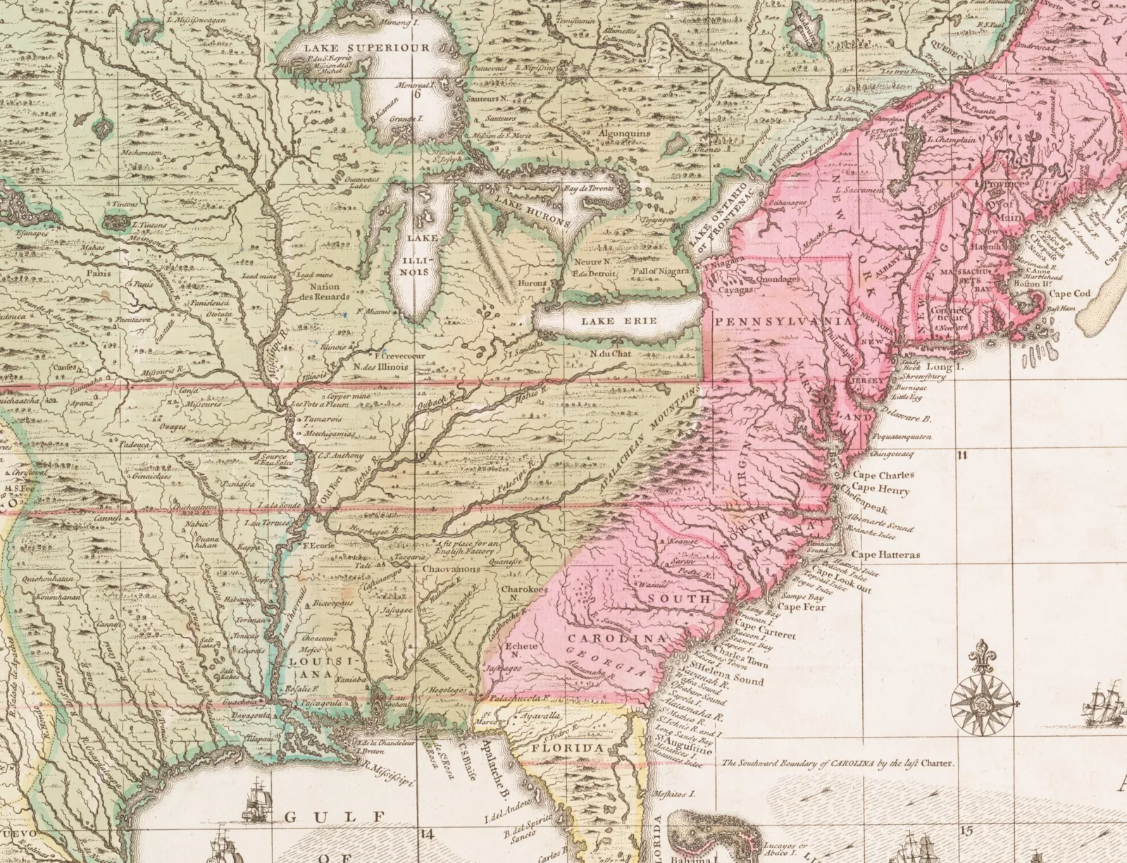
Meanwhile, England's paper claims kept growing. Georgia's 1732 charter did what Carolina's had done on a smaller scale, and by 1732 much of Mississippi was claimed simultaneously by England and by France.8 These broadly written charters would matter enormously a century and a half later—Georgia's claim would take an act of Congress, a Supreme Court decision, and a national scandal to extinguish—but at the time they described nothing anyone could actually find on the ground. Mississippi's northern line has a similar paper origin. In 1735, North and South Carolina agreed on the 35th parallel as their dividing line west of the mountains, and it later separated western North Carolina, which is now Tennessee, from western Georgia, which later became Mississippi and Alabama.9
1763: the 31st degree parallel
The end of the Seven Years' War in 1763 ended French dominion in Mississippi. In the Treaty of Paris of February 10, 1763, Great Britain took everything France held east of the Mississippi River except New Orleans and its island, and Spain ceded Florida to Great Britain in exchange for the return of Havana. France had already transferred the territory west of the river to Spain by a secret treaty in 1762.10
The treaty also set the great dividing line of the interior: a line down the middle of the Mississippi River from its source to the Iberville River, and then down the middle of the Iberville River and Lakes Maurepas and Pontchartrain to the sea. That description is the direct ancestor of today's Mississippi–Louisiana boundary.
Then, by the Royal Proclamation of October 7, 1763, King George III created the Province of West Florida: the territory west of the Apalachicola River, east of the Mississippi River and the Iberville–Pontchartrain line, and—critically—south of the 31st parallel of north latitude, the straight line which partially separates present-day southwest Mississippi and Louisiana.11 The same proclamation confirmed Georgia's claim to everything north of 31°.
The most significant British act during this period was a 1765 treaty with twenty-nine Choctaw and Chickasaw chiefs. It memorialized the first formal extinguishment of Indian land title in the region, covering land west of the confluence of the Tombigbee and Mobile Rivers to the Mississippi River and south of the 31st parallel to the Gulf.12 The first recorded land grants in West Florida were made in January 1768, largely to retired British naval and military officers,13 and these grants, along with inexperience in organizing sections and townships, are the reasons some townships in this region of Mississippi have more than 36 sections, most of which are irregularly shaped.
1764: Britain moves the line north
Almost immediately, the 31st parallel proved inconvenient. It cut below Natchez, leaving Britain's most promising settlement in the interior outside its own province and inside Georgia's charter claim. So in July 1764, in the commission issued to West Florida's first governor, Great Britain simply redefined the province: its northern limit was extended to a line running due east from the junction of the Yazoo and Mississippi Rivers to the Chattahoochee River.14
That line—originally the 32°28′ north latitude, though the Yazoo River's mouth has shifted since—is the "Yazoo line." It brought Natchez and much of present Mississippi and Alabama into West Florida, implicitly shrinking Georgia.
Post-Revolutionary War
British dominion in Mississippi lasted less than twenty years. On May 8, 1779, during the American Revolutionary War, Spain declared war on Great Britain as a cobelligerent. Bernardo de Gálvez, then civil and military governor of Louisiana, moved fast. Within two years Gálvez had taken Baton Rouge, Mobile, and Pensacola, and with them the whole province of West Florida.15
Here a Mississippi boundary problem begins in earnest. In 1783, two separate treaties of Paris ended the Revolutionary War. In the treaty with the United States, Great Britain recognized American independence and described the new nation's southern boundary as the 31st parallel. In the separate treaty with Spain, Great Britain retroceded East and West Florida—without specifying their boundaries.16
Spain took the obvious position. It had conquered West Florida as the British had defined it, and Britain had defined it northward to the Yazoo line. When the American peace treaty set the line at 31°, Spain refused to be bound by an agreement to which it was not a party. Spain insisted its northern line ran to the mouth of the Yazoo River at present-day Vicksburg, and at one point claimed it ran as far north as the Chickasaw Bluffs—modern Memphis.17 By 1784 Spain was formally claiming most of the southwestern United States, though it did not actually control much of the interior.18
Meanwhile Americans poured into the Natchez District, confident that title would soon pass to the United States. They lived under Spanish law—including its prohibition on non-Catholic public worship—and simply worshipped, baptized, and read scripture in their homes. The Spanish were largely tolerant of the practice, and in most respects the Spanish government and the American residents got along.19
These settlers also got land. On April 20, 1784, the first survey of lands in the Natchez District was ordered. By then Natchez had 1,550 residents against Mobile's 745 and Baton Rouge's 270. Spanish grants were easy to obtain and not cost-prohibitive: a citizen requested an unoccupied parcel and ordered a survey; assuming no conflict, the governor issued the survey order, and on return of the plat and payment of a moderate fee a patent issued.20 Those grants are still the root of title in much of southwest Mississippi.
The Yazoo Land Fraud—Georgia's claim, and the largest land fraud in American history
While Spain held the ground, Georgia held a charter—and Georgia's legislators tried twice to convert this claim into ownership.
First, on February 7, 1785, the Georgia legislature created Bourbon County, defining it as all the land east of the Mississippi River between the mouth of the Yazoo River and the 31st parallel—which was precisely the tract Spain was occupying. Georgia's claimed authority rested on its colonial charter as confirmed by the 1763 settlement. After a few years and considerable political outrage, Georgia repealed the act in 1788 and later ceded its claims west of the Chattahoochee River.21
Georgia's second attempt was worse. In 1795, the Georgia legislature—its members induced by ownership shares in the purchasing companies—conveyed 35,000,000 acres in what is now Alabama and Mississippi to a handful of land speculation companies for $500,000, less than two cents an acre.22 The tract ran from the Mississippi River on the west, along the 31st parallel south to Mobile Bay, up the Tensaw, Alabama, and Coosa Rivers to their source near Rome, Georgia, then to the top of Lookout Mountain, and then west along Georgia's northern boundary back to the Mississippi River.23
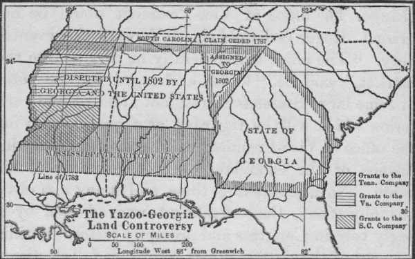
Public fury ensued and the people swept the legislature out. The new legislature repealed the sale in 1796,24 and in 1802 Georgia ceded to the United States all its claims west of its present boundary.25 By then, most of the land had been resold to third parties who had paid value without notice of the bribery. In 1803 Congress created a process for confirming titles claimed under Spanish or English grants, by actual possessors and residents, and under the Georgia cession—but as to private claimants under Georgia, the cession agreement confirmed only those claiming under the Bourbon County act.26 Congress and Georgia evidently assumed the repeal had dealt with the Yazoo grants.
The Supreme Court disagreed. In Fletcher v. Peck (1810), the Court held that subsequent bona fide purchasers held good title, and that Georgia's repealing legislation was an unconstitutional impairment of a contract.27 Congress cleaned up the mess on March 31, 1814 with a statute allowing Yazoo claimants to release and assign their claims to the United States in exchange for "Mississippi stock" payable out of public land sale proceeds, up to a ceiling of $5 million, with all unreleased claims barred after one year.28 Claims to millions of acres were released, and the land became public domain.29
There is no practical consequence for today's title examiner: essentially no private Mississippi title traces to the Yazoo sales. It only traces to British grants, Spanish grants, or the federal public land system.
1795–1798: the 31st parallel becomes the settled line
The Treaty of San Lorenzo—also known as Pinckney's Treaty—was signed on October 27, 1795 and ratified the following spring. It fixed the 31st parallel as the dividing line between Spanish West Florida and the United States, guaranteed free navigation of the Mississippi River with the right of deposit at New Orleans, and provided that boundary commissioners and surveyors would meet at Natchez to run the line.30
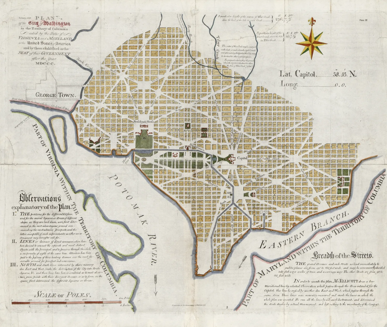
Andrew Ellicott, the American boundary commissioner, arrived in Natchez in February 1797. By then, Ellicott was famous for making the first accurate measurement of Niagara Falls, serving as surveyor general of the United States, and making the first surveys of the District of Columbia.31 On arrival he took astronomical observations and determined that Natchez sat at 31° 33′ 46″ north latitude—about thirty-nine miles north of the line he had come to run.
The Spanish had no intention of leaving quickly. They made excuses, delayed evacuation, strengthened their garrisons, and worked to persuade leaders of the western states to detach from the Union and ally with Spain. But as American troops accumulated at Natchez the delay lost its appeal, and they eventually evacuated in March 1798, ending Spanish dominion at Natchez.32
The survey began on April 9, 1798. Ellicott and Spain's representatives—Captain Stephen Minor and William Dunbar, the Natchez planter and scientist—met at Bayou Tunica. Dunbar's party ran west to the Mississippi River while Ellicott went east. At the river, a ten-foot post was set eighty-eight feet from the bank, marking the international boundary between Spain and the United States.33
Ellicott continued east. On April 10, 1799, on the west bank of the Mobile River, he set an inscribed stone on the line. Ellicott's Stone is still the initial point of the St. Stephens Meridian, from which public-land surveys across southeastern Mississippi and southern Alabama are measured. Every township-and-range description in that part of the state is, in a sense, tied back to it (see The Basics of Legal Descriptions in Mississippi).34


Ellicott's line is still the boundary between Mississippi and Louisiana from the Mississippi River to the Pearl River. It is not perfectly on the 31st parallel, since no line run with 1798 instruments could be. Modern estimates put it a few hundred feet off (at the stone, about 500 feet south of the true parallel), but it is the line that governs.35
The Mississippi Territory
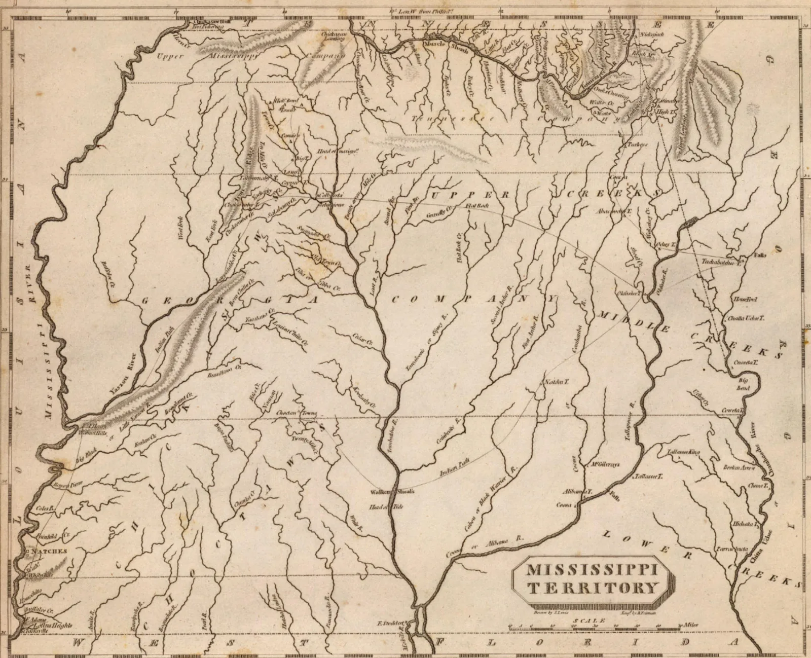
Congress did not wait for Ellicott's survey. On April 7, 1798, Congress created the Mississippi Territory: bounded on the west by the Mississippi River, on the north by the Yazoo line running due east to the Chattahoochee River, on the east by the Chattahoochee River, and on the south by the 31st parallel. The act carefully preserved Georgia's claim, providing that creation of the territory would not impair it.36 Natchez was the first capital; the seat moved to the town of Washington in 1802.
After the Georgia cession of April 24, 1802, Congress extended the territory north on March 27, 1804, absorbing the unorganized federal land between the Yazoo line and the Tennessee boundary. The same act barred land certificates for any land where Indian title had not been extinguished, an early admission that the line on paper ran well ahead of the government's reach.37 With that, the Mississippi Territory reached from 31° to 35°—everything that is now Mississippi and Alabama except the Gulf Coast.
West Florida: the coast Mississippi almost didn't get
The Gulf Coast counties were the last piece, and they arrived by way of the most audacious American legal argument of the era.
In 1800, Spain retroceded Louisiana to France by the secret Third Treaty of San Ildefonso, in exchange for territories in Tuscany. Spain, allied with France against Great Britain and unable to defend New Orleans, wanted a French buffer between the Americans and its remaining possessions further west.38
France, under Napoleon Bonaparte, who had risen to power in 1799, had set its eyes on the sugar trade of the Caribbean. In 1801, Napoleon sent a large military force to retake Saint-Domingue, present-day Haiti, which France had lost to a slave revolt in the 1790s. With Louisiana secured, France would have a nearby source of supply for its sugar islands. A powerful France on the Mississippi River was too close for comfort, and it caused an unsettled feeling among the Americans.39
Thomas Jefferson, the third president of the United States, feared that France would cut off the Mississippi River from American commerce. And in October 1802, the Spanish acting intendant of Louisiana announced that he would revoke the right of deposit at New Orleans for all cargo from the United States, angering Americans, who blamed France. To resolve the issue, Jefferson instructed Robert Livingston, the American minister in Paris, and sent James Monroe to join him, to negotiate with Napoleon for the purchase of New Orleans and free navigation of the Mississippi River. Meanwhile, Napoleon's forces were taking a beating in Saint-Domingue, losing around 40,000 soldiers in only ten months, Spain had refused to sell Florida to France, and sentiment against France was growing in the United States. Napoleon was losing patience with his campaign in the Americas. And so, he instructed his ministers to offer the entire Louisiana territory to the United States—right away.40
When these ministers approached Livingston and Monroe about selling the entire Louisiana territory, the Americans were confused. Their authority extended only to the purchase of New Orleans, not the entire territory. They agreed, however, that obtaining approval from the president would take too long and that Napoleon could withdraw his offer at any time. So they began negotiating immediately, and they secured the entire 828,000-square-mile territory for the equivalent of about $15 million in U.S. bonds and assumed debts. Napoleon in turn sold the bonds at a discount and received only $8,831,250 in cash for Louisiana. Jefferson had authorized $10 million for the City of New Orleans alone; for $5 million more, he got a deal that doubled the size of the country. Although the Federalists opposed the deal on constitutional grounds, fearing they would lose power in Congress to new western states, the Senate ratified the treaty in 1803, and westward expansion began.41

What the United States had actually bought was famously undefined. When Livingston asked Charles Maurice de Talleyrand, Napoleon's foreign minister, for the eastern boundary of Louisiana, Talleyrand replied that he did not know, and told him to take it as France had received it. Pressed, he added that the Americans had made a noble bargain and would no doubt make the most of it.42
They did. The United States claimed that everything west of the Perdido River—the line the French and Spanish commanders had agreed to in 1719—was part of Louisiana and therefore part of the purchase, even though Spain was actually governing it. Spain regarded the claim as baseless.43 Congress nonetheless enacted legislation asserting the right to annex the territory,44 which infuriated the Spanish,45 and Spain rebuffed an American mission sent to settle the boundary.46
In 1810, residents of the Baton Rouge district, who preferred American protection to Spanish rule, seized the Spanish garrison at Baton Rouge, declared the independent Republic of West Florida, and asked President James Madison to annex it.47 Madison promptly proclaimed the territory part of the Territory of Orleans,48 and Britain and Spain both objected.49 The proclamation claimed everything to the Perdido River, but American control reached only to the Pearl River. Spain still held Mobile and the coast that is now Mississippi's.
The division that followed is why the Mississippi Gulf Coast is in Mississippi and the Florida Parishes are in Louisiana. In 1812 Congress split the disputed strip at the Pearl River:
- By the Act of April 14, 1812, the land between the Mississippi River and the Pearl River was added to the new State of Louisiana.50
- By the Act of May 14, 1812, Congress enlarged the Mississippi Territory to take in "all that portion of the territory lying east of the Pearl river, west of the Perdido, and south of the 31st degree of north latitude."51
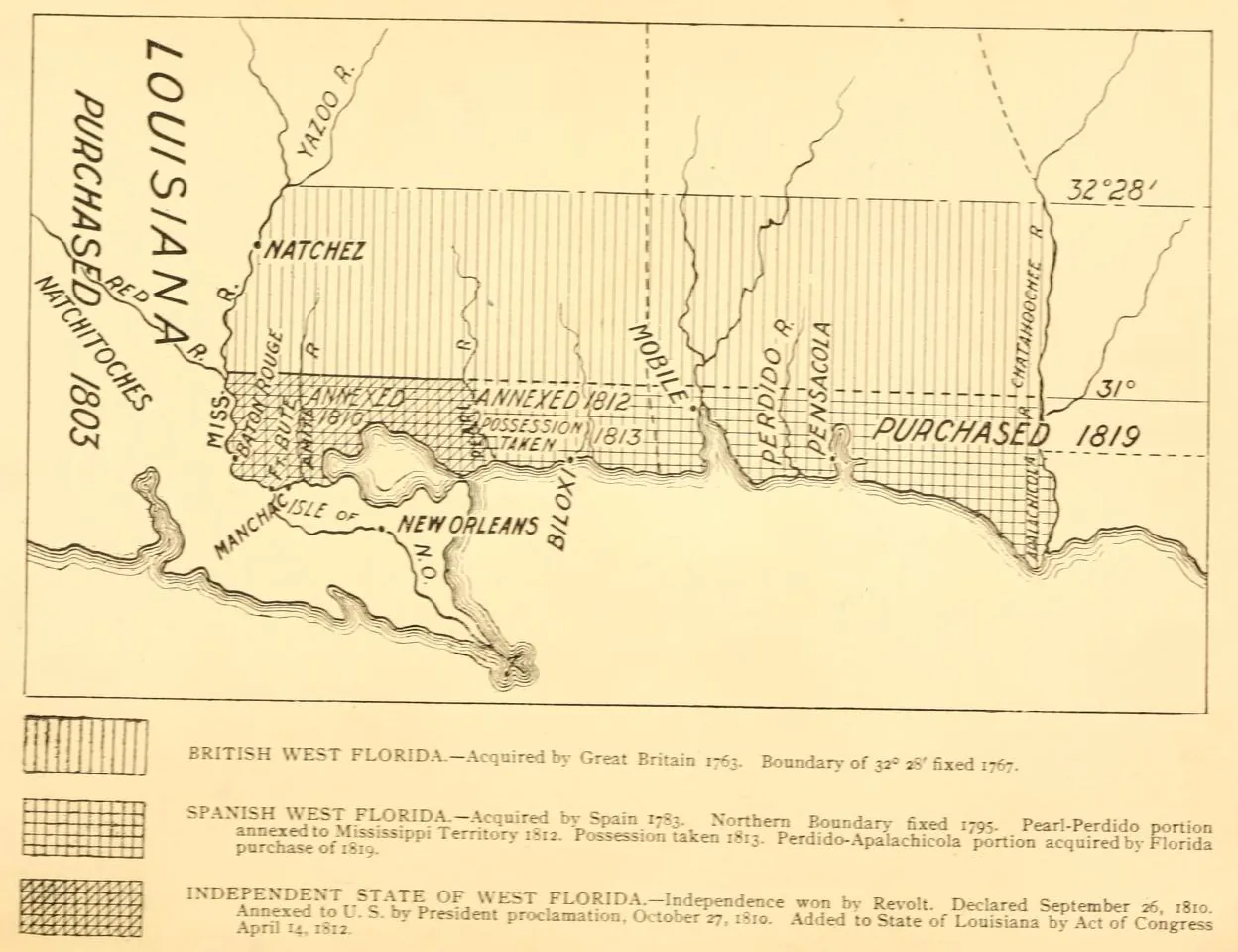
Congress had already, by a secret act of January 15, 1811, authorized the President to occupy the territory should a foreign power attempt to take it.52 The moment was well chosen: King Charles IV of Spain and his son Ferdinand VII had both abdicated, Napoleon had installed his brother Joseph on the Spanish throne, and Spain had no central authority to object.53 The Mississippi Territory organized Hancock and Jackson counties on the coast in December 1812, four months before it controlled them.54 American forces took Mobile on April 15, 1813, making the annexation effective on the ground. Spain formally ceded the territory, along with East Florida, in the Adams–Onís Treaty of 1819, ending Spanish dominion east of the Mississippi River.55
1817: cutting the territory in two
By 1817 the Mississippi Territory ran from the Tennessee line to the Gulf of Mexico and from the Mississippi River to the Chattahoochee River, and its settlers disagreed about whether it should enter the Union as one state or two. The river counties around Natchez had first pushed for a single state. By 1816, though, the faster-growing eastern settlements along the Pearl and Tombigbee Rivers expected to outvote Natchez, and that October a convention of eastern delegates asked Congress to admit the territory as a state "entire and without division." The river counties then asked for division instead. The Senate favored two states, and the territorial delegate, William Lattimore, concluding that Congress would never admit the whole territory as one state, asked for a line.56
Congress split it. The Act of March 1, 1817 authorized the western part to form a constitution and be admitted; the Act of March 3, 1817 created the Alabama Territory out of the eastern part.
Mississippi's enabling act described the new state's limits as follows:
Beginning on the river Mississippi at the point where the southern boundary line of the state of Tennessee strikes the same; thence east along the said boundary line to the Tennessee river; thence up the same to the mouth of Bear creek; thence by a direct line to the northwest corner of the county of Washington; thence due south to the Gulf of Mexico; thence westwardly, including all the islands within six leagues of the shore, to the most eastern junction of Pearl river with Lake Borgne; thence up said river to the thirty-first degree of north latitude; thence west along the said degree of latitude to the Mississippi river; thence up the same to the beginning.57
The convention met at the town of Washington on July 7, 1817. More than half its delegates came from five plantation counties along the river, and misgivings about the eastern line nearly broke it up, but on August 15 it adopted the state's first constitution, repeating that description verbatim in the preamble. Mississippi was admitted on December 10, 1817, as the twentieth state.
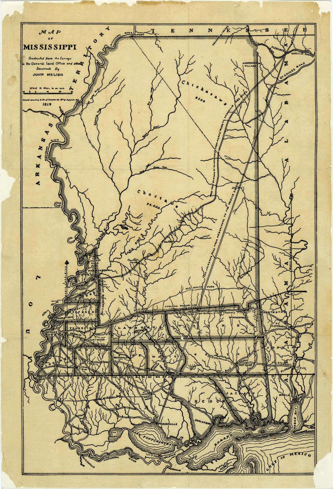
Two features of that description are worth pausing on.
Why the eastern line bends. The Senate's own preference had been a line at the Tombigbee River.58 What Congress enacted instead was a line strung between two points that were already on the map. The angle point, the northwest corner of Washington County, Alabama, had been fixed in 1809 where the east–west Choctaw boundary of the 1765 treaty crossed an old trail running north from Mobile. It sits just north of present-day Evansboro in Choctaw County, Alabama, and it gave Congress a surveyable anchor in country that was otherwise unsurveyed. From there the line runs due south toward the Gulf, and northeast to the mouth of Bear Creek on the Tennessee River. Bear Creek was also a recorded landmark: the western limit of Georgia's 1789 and 1795 Tennessee company grants, which in turn followed the traditional Chickasaw–Cherokee division along the river.59 Ending the line at Bear Creek, instead of running it straight on to the Tennessee border, kept Mississippi from being handed a scrap of hill country cut off from the rest of the state by the wide Tennessee River, and it gave Alabama its northwest "ear."60 The mouth of Bear Creek now lies under Pickwick Lake.
Six leagues. The phrase "including all the islands within six leagues of the shore" was Congress's way of capturing the barrier chain that forms the southern edge of Mississippi Sound—Cat Island, Ship Island, Horn Island, Petit Bois Island, and the rest. Alabama's admission act used the same formula. Louisiana's, five years earlier, had used three leagues. That mismatch produced the Lake Borgne litigation covered in Part 2. The clause also fed a later offshore claim that did not survive: Mississippi read "six leagues" as support for a seabed boundary three marine leagues out, and in 1960 the Supreme Court held that the clause identified which islands belonged to the state, not how far its seabed ran. Section 3-3-1 of the Code still claims more. As amended in 2013, it describes the state's territorial waters by reference to the 1817 act and extends the belt off Cat Island, Ship Island, Horn Island, and Petit Bois Island to three marine leagues.61 For federal purposes the 1960 judgment controls, so the statute is best read as a state claim, not settled law.
The southern end of the Alabama line was adjusted almost immediately. Run due south, the line would have reached the Gulf near the east side of Pascagoula Bay, cutting the settlers there off from their kin and trade on the west side.62 Alabama's enabling act of March 2, 1819 told the surveyors that if the due-south line would encroach on Wayne, Greene, or Jackson counties, they were instead to run a direct line from the Washington County corner "to a point on the Gulf of Mexico, ten miles east of the mouth of the river Pascagola."63 It would have, so they did. John Coffee and Thomas Freeman met at St. Stephens in May 1820 to plan the survey and finished it that July. The terminus, ten miles east of the mouth of the Pascagoula River, sits about 3.7 miles east of where the "due south" call would have put it, so Mississippi gained a thin wedge from Alabama's Washington, Baldwin, and Mobile counties.64 That is why the current Mississippi Constitution describes the line as running from "what was formerly the northwest corner of the county of Washington, Alabama" on a direct line to a point ten miles east of the Pascagoula River, rather than tracking the 1817 language.65
The lines on paper and the land on the ground
The boundary described in 1817 took in far more land than the new state actually governed. White settlement and county government were concentrated in the southwest and along the coast. Most of the center of the state was Choctaw land, and the north was Chickasaw. The outer line was legally complete in 1817, but state authority inside it arrived one cession at a time:
| Treaty | Year | Nation | Land ceded (approx.) | Effect |
|---|---|---|---|---|
| Fort Adams | 1801 | Choctaw | 2.6 million acres | Natchez District cession redefined; Natchez Trace permitted |
| Mount Dexter | 1805 | Choctaw | 4.1 million acres | Southern cession between the Natchez and Tombigbee settlements |
| Doak's Stand | 1820 | Choctaw | 5.2 million acres | The "New Purchase" in west-central Mississippi |
| Dancing Rabbit Creek | 1830 | Choctaw | 10.4 million acres | All remaining Choctaw land east of the Mississippi River |
| Pontotoc Creek | 1832 | Chickasaw | 6.3 million acres | The remaining Chickasaw homeland in north Mississippi |
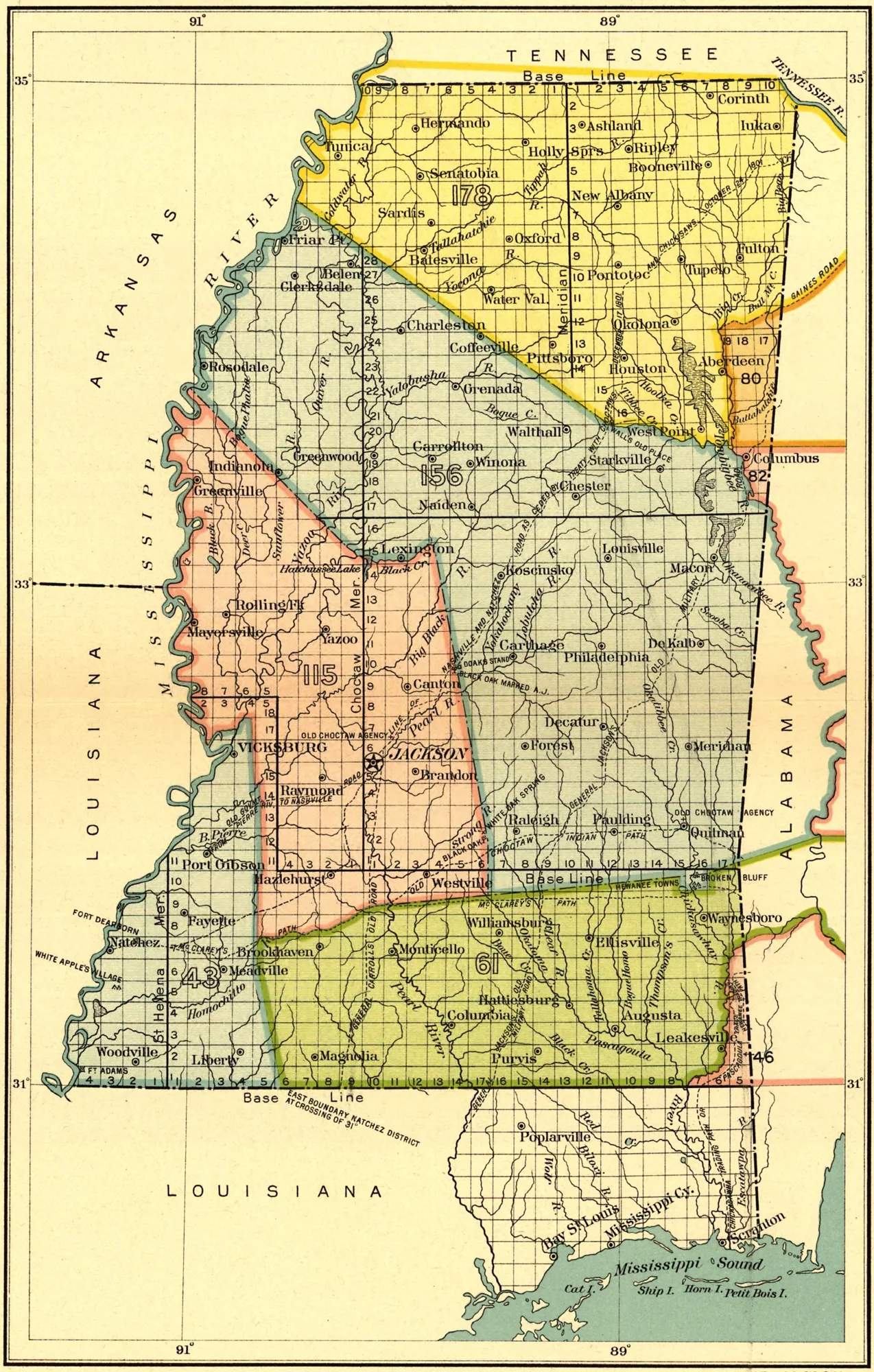
Acreage figures vary by source. The Doak's Stand treaty promised boundaries that "shall remain without alteration," and the promise did not last a decade. In January 1830, before Dancing Rabbit Creek was negotiated, the Legislature voted to extend state jurisdiction over the Choctaw lands. That vote was the coercive backdrop to the treaty John Eaton and John Coffee obtained that September. Article XIV of the treaty allowed Choctaws who wished to stay to become citizens with 640-acre allotments, but the allotments were widely disregarded, and many who stayed became squatters on their former land. They are the origin of today's Mississippi Band of Choctaw Indians.66
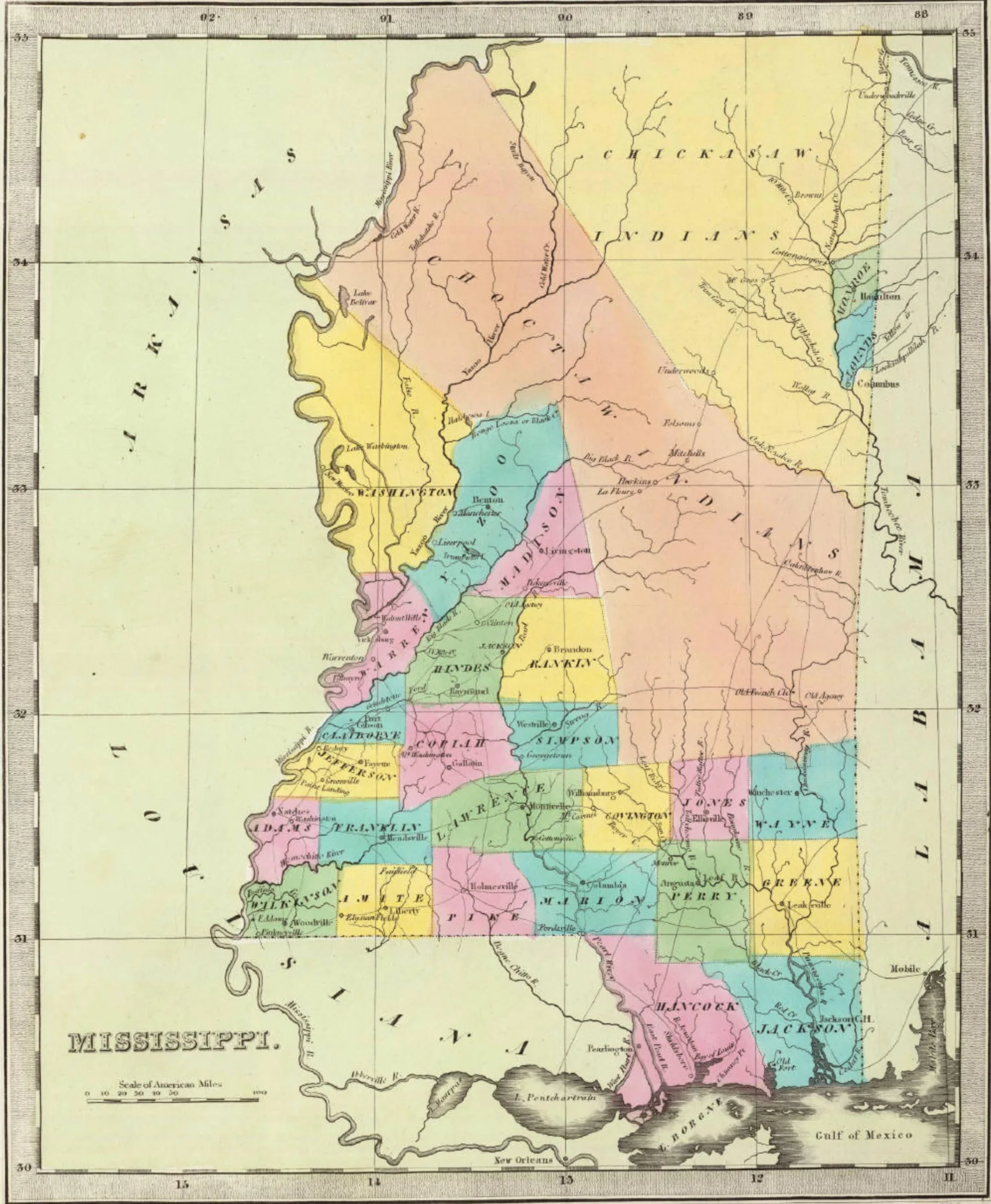
For title purposes this is the second half of the root-of-title story. Southwest Mississippi traces to British and Spanish grants and the early federal confirmations of them. Most of the rest of the state traces to federal patents issued after these cessions (236,894 acres were sold in 1832 alone),67 surveyed off meridians laid out for each new block of territory. Tribal trust lands within the state remain a distinct jurisdictional layer today.
The Tennessee line: the 35th parallel, missed twice
The 1817 act did not describe a northern line of its own. It borrowed "the southern boundary line of the state of Tennessee," which Tennessee's 1796 admission had placed on the 35th parallel. No one marked it on the ground until after the Chickasaw cession of 1818. In 1819 General James Winchester, a federal official, ran the line. He put it too far north.
Mississippi, not Tennessee, reopened the question. Governor Gerard Brandon urged a retrace in 1829, drawn in part by the prize of the Chickasaw Bluffs and the young town of Memphis. Then Mississippi's own experimental survey, run by Major John Holland in 1831, showed the opposite of what the state had hoped: Winchester's line was too far north, so correcting it would cost Mississippi land. Mississippi backed off. Tennessee's governor, William Carroll, insisted on finishing what Mississippi had started.
In 1837 a joint commission ran a new line by astronomical observation. Mississippi's commissioners were B.A. Ludlow, D.W. Connelly, and W. Petrie; Tennessee's were J.D. Graham and Austin Miller. The line ran from a point on the Tennessee River six chains south of the mouth of Yellow Creek to a point on the Mississippi River opposite Cow Island. At the river it lay four and a half miles and 514 feet south of Winchester's terminus, and Tennessee gained 215,927 acres. Mississippi's Constitution of 1890 declares that line the true boundary.68
It still misses. Writing in 1930, Judge Samuel Cole Williams reported that government surveys put the line about half a mile south of the true parallel.69 That does not matter: both states accept the 1837 line, so the surveyed line, not the astronomical parallel, is the law. The most recent Mississippi–Tennessee case in the Supreme Court was about what lies beneath the line, not where it runs. In Mississippi v. Tennessee (2021), the Court unanimously held that the Memphis Sand aquifer is an interstate resource subject to equitable apportionment, and it rejected Mississippi's claim to own the groundwater on its side of the border.70
Timeline
| Date | Event |
|---|---|
| 1540–41 | Hernando de Soto crosses Mississippi; Spain claims the region by discovery |
| 1663, 1665 | Carolina charters run west to the Pacific; on paper they cover all of present Mississippi |
| 1673 | Marquette and Joliet descend the Mississippi River to the mouth of the Arkansas River |
| 1682 | La Salle claims the Mississippi River valley for France |
| 1699 | Fort Maurepas built near present-day Ocean Springs |
| 1716 | Bienville builds Fort Rosalie at Natchez |
| 1719 | French and Spanish commanders agree on the Perdido River as the Louisiana–Florida line |
| 1732 | Georgia chartered; overlapping English and French claims |
| 1735 | North and South Carolina agree on the 35th parallel west of the mountains |
| Feb. 10, 1763 | Treaty of Paris: Britain takes everything east of the Mississippi River except New Orleans |
| Oct. 7, 1763 | Royal Proclamation creates West Florida, north boundary at 31° |
| 1764 | Britain moves West Florida's north line to the Yazoo line (≈32°28′) |
| 1765 | British treaty with the Choctaw and Chickasaw; its line later anchors the Washington County corner |
| 1768 | First recorded British land grants in West Florida |
| 1779–81 | Gálvez conquers West Florida for Spain |
| 1783 | Britain cedes the Floridas to Spain without stating boundaries; U.S.–British line set at 31° |
| 1784 | First survey of lands in the Natchez District ordered |
| 1785–88 | Georgia's Bourbon County created and repealed |
| 1795 | Yazoo land sale; Treaty of San Lorenzo fixes 31° |
| 1796 | Georgia repeals the Yazoo sale; Tennessee admitted, its southern line on the 35th parallel |
| 1797–98 | Ellicott at Natchez; Spain evacuates Natchez |
| Apr. 7, 1798 | Mississippi Territory created: 31° to the Yazoo line, Mississippi River to the Chattahoochee River |
| Apr. 9, 1798 | Ellicott's survey of the 31st parallel begins |
| Apr. 10, 1799 | Ellicott's Stone set on the Mobile River, the St. Stephens Meridian's initial point |
| 1800 | Third Treaty of San Ildefonso: Spain retrocedes Louisiana to France |
| 1801, 1805 | Fort Adams and Mount Dexter cessions |
| Apr. 24, 1802 | Georgia cedes its western claims |
| 1803 | Louisiana Purchase |
| Mar. 27, 1804 | Mississippi Territory extended north to the Tennessee line |
| 1810 | West Florida revolt; Madison proclaims annexation; Fletcher v. Peck |
| Jan. 15, 1811 | Secret act authorizes the President to occupy West Florida |
| Apr. 14, 1812 | Land between the Mississippi River and the Pearl River added to Louisiana |
| May 14, 1812 | Land between the Pearl River and the Perdido River added to the Mississippi Territory |
| Dec. 1812 | Hancock and Jackson counties organized on the coast |
| Apr. 15, 1813 | U.S. forces take Mobile |
| Mar. 31, 1814 | Congress buys out the Yazoo claims |
| Oct. 1816 | Eastern delegates ask Congress to admit the territory as one state |
| Mar. 1 & 3, 1817 | Enabling act for Mississippi; Alabama Territory created |
| Aug. 15, 1817 | First constitution adopted |
| Dec. 10, 1817 | Mississippi admitted to the Union |
| 1819 | Adams–Onís Treaty; Spain cedes the Floridas |
| Mar. 2, 1819 | Alabama enabling act orders the coastal diagonal |
| 1819 | Winchester runs the Tennessee line, too far north |
| May–July 1820 | Mississippi–Alabama line surveyed; terminus ten miles east of the Pascagoula River |
| 1820, 1830, 1832 | Doak's Stand, Dancing Rabbit Creek, and Pontotoc Creek cessions |
| 1831 | Holland's survey shows that correcting the Tennessee line would cost Mississippi land |
| 1837 | Tennessee line resurveyed; Tennessee gains 215,927 acres |
| 1890 | State constitution adopts the 1837 line |
| 2021 | Mississippi v. Tennessee: the Memphis Sand aquifer |
Part 2: the litigation
By 1837, Mississippi's land boundaries were drawn and surveyed. Its water boundaries were another matter. The Mississippi River kept moving, and the 1812 and 1817 acts of Congress described the coast in ways that did not agree with each other. Over the next century and a half, those boundaries went to the Supreme Court of the United States again and again: against Louisiana over Lake Borgne and Mississippi Sound, against Arkansas and Louisiana over the river, and against the United States over how far offshore the state runs.
Part 2 covers those cases, the rules they established, and why the same rules still matter to anyone examining a title along the river or the coast.
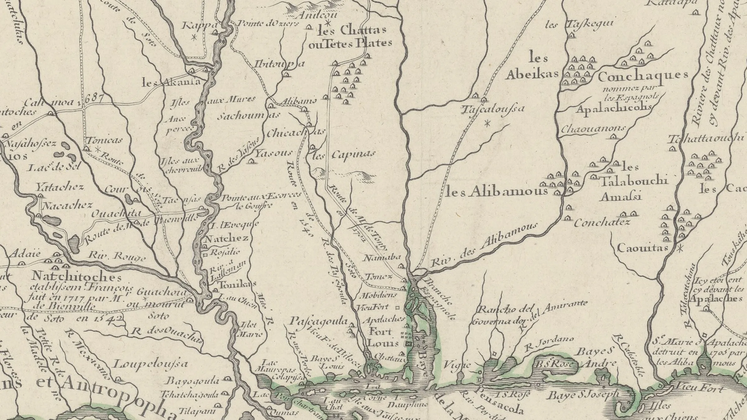
Title image: Guillaume Delisle, Carte de la Louisiane et du cours du Mississipi (Paris, 1718), detail. Bibliothèque nationale de France.
-
1 Dunbar Rowland, History of Mississippi: The Heart of the South 106–14 (The Reprint Company 1978) [hereinafter Rowland, History of Mississippi]; David Morgan, Archaeological Report No. 26: The Mississippi De Soto Trail Mapping Project 3–4 (Miss. Dept. of Archives and History 1997). ↩
-
Mississippi: Consolidated Chronology of State and County Boundaries, Atlas of Historical County Boundaries (Newberry Library 2007) (entries for 24 Mar. 1663 and 30 June 1665, citing Swindler, 7:357–58, 7:375) [hereinafter Newberry, Mississippi Chronology]. ↩
-
Rowland, History of Mississippi, supra n. 1, at 122. ↩
-
Id. at 125–30. ↩
-
Id. at 135–51; Newberry, Mississippi Chronology, supra n. 2 (entry for 8 Apr. 1699). ↩
-
Rowland, History of Mississippi, supra n. 1, at 172–79 (site selection), 199–222 (construction of the fort at Natchez, 1716). ↩
-
Newberry, Mississippi Chronology, supra n. 2 (entry for 1719, citing Cox, 8). ↩
-
Rowland, History of Mississippi, supra n. 1, at 237–38; Newberry, Mississippi Chronology, supra n. 2 (entry for 9 June 1732). ↩
-
Historic Origins of Alabama's Boundaries, Encyclopedia of Alabama, https://encyclopediaofalabama.org/article/historic-origins-of-alabamas-boundaries/ [hereinafter Origins of Alabama's Boundaries]. ↩
-
Rowland, History of Mississippi, supra n. 1, at 244; Treaty of Paris, Feb. 10, 1763, art. VII. ↩
-
Rowland, History of Mississippi, supra n. 1, at 253; Royal Proclamation of Oct. 7, 1763; Newberry, Mississippi Chronology, supra n. 2 (entry for 7 Oct. 1763). ↩
-
Rowland, History of Mississippi, supra n. 1, at 261–64. ↩
-
Id. at 264–65. ↩
-
Newberry, Mississippi Chronology, supra n. 2 (entry for July 1764, citing Cappon, Petchenik, and Long, 87). ↩
-
Rowland, History of Mississippi, supra n. 1, at 271–75, 285–94; Newberry, Mississippi Chronology, supra n. 2 (entry for 8 May 1781). ↩
-
Newberry, Mississippi Chronology, supra n. 2 (entry for 3 Sept. 1783, citing Parry, 48:481, 487, 491–92; Van Zandt, 12). ↩
-
Rowland, History of Mississippi, supra n. 1, at 294–96. ↩
-
Newberry, Mississippi Chronology, supra n. 2 (entry for 29 July 1784). ↩
-
Rowland, History of Mississippi, supra n. 1, at 296–97. ↩
-
Id. at 298–301. ↩
-
Id. at 301–03; Newberry, Mississippi Chronology, supra n. 2 (entries for 7 Feb. 1785 and 1 Feb. 1788). ↩
-
Cady v. Jardine, 185 Ga. 9, 10 (Ga. 1937). ↩
-
Letter from James Seagrove, Agent of Indian Affairs, to George Washington, President of the United States (Jan. 13, 1795), available at http://founders.archives.gov/documents/Washington/05-17-02-0264. ↩
-
Lutz v. Foran, 262 Ga. 819, 825 n.7 (Ga. 1993). ↩
-
Articles of Agreement and Cession (Apr. 24, 1802), published in American State Papers, Public Lands, Vol. 1, 113–14 (Gales and Seaton 1834). ↩
-
2 Stat. 229 (1803); American State Papers, Public Lands, Vol. 1, 114. ↩
-
Fletcher v. Peck, 10 U.S. 87 (1810). ↩
-
Act of Mar. 31, 1814, 3 Stat. 116. ↩
-
American State Papers, Public Lands, Vol. 2, 743–48. ↩
-
Rowland, History of Mississippi, supra n. 1, at 311–12; Newberry, Mississippi Chronology, supra n. 2 (entry for 27 Oct. 1795). ↩
-
Rowland, History of Mississippi, supra n. 1, at 314–16. ↩
-
Id. at 316–24. ↩
-
Id. at 324–25. ↩
-
Ellicott Stone, Historic Civil Engineering Landmarks, American Society of Civil Engineers, https://www.asce.org/about-civil-engineering/history-and-heritage/historic-landmarks/ellicott-stone. ↩
-
Ellicott Stone, supra n. 34; Ellicott's Line, 64 Parishes (Louisiana Endowment for the Humanities), https://64parishes.org/ellicotts-line (line "less than eight hundred feet off" modern satellite measurements). ↩
-
1 Stat. 549 (1798); Newberry, Mississippi Chronology, supra n. 2 (entry for 7 Apr. 1798). ↩
-
2 Stat. 305 (1804); Newberry, Mississippi Chronology, supra n. 2 (entry for 27 Mar. 1804). ↩
-
Charles Gayarré, History of Louisiana 393–446 (1863). ↩
-
Roger L. Kemp, Documents of American Democracy 160–61 (McFarland & Company 2010). ↩
-
Id. at 161. ↩
-
Id. ↩
-
2 Henry Adams, History of the United States of America During the First Administration of Thomas Jefferson ch. 2 (Charles Scribner's Sons 1889) (quoting Talleyrand); see Letter from Robert R. Livingston to James Madison (May 20, 1803), American State Papers, Foreign Relations, Vol. 2, 561. ↩
-
Newberry, Mississippi Chronology, supra n. 2 (entry for 30 Apr. 1803, citing Cox, facing 2, 84–101). ↩
-
2 Stat. 251 (1804) (the Mobile Act). ↩
-
Letter from James Madison, U.S. Secretary of State, to Robert R. Livingston, U.S. Minister to France (Mar. 31, 1804); see also Letter from James Monroe, U.S. Secretary of State, to Chevalier De Onís (Jan. 19, 1816), American State Papers, Foreign Affairs, Vol. 4, 424. ↩
-
Communication from Thomas Jefferson, President of the United States, to Congress, American State Papers, Foreign Affairs, Vol. 2, 613. ↩
-
Henry E. Chambers, West Florida and Its Relation to the Historical Cartography of the United States 27–34 (The Johns Hopkins Press 1898). ↩
-
Proclamation 16 (Oct. 27, 1810). ↩
-
Chambers, West Florida, supra n. 47, at 34–35. ↩
-
2 Stat. 708 (1812) (Act of Apr. 14, 1812). See also 2 Stat. 701 (1812) (Act of Apr. 8, 1812, admitting Louisiana). ↩
-
2 Stat. 734 (1812) (Act of May 14, 1812). ↩
-
3 Stat. 471 (Act of Jan. 15, 1811). ↩
-
See generally Encyclopaedia Britannica vol. X, 267 (11th ed., University Press 1910). ↩
-
Newberry, Mississippi Chronology, supra n. 2 (entries for Dec. 1812). ↩
-
Treaty of Amity, Settlement, and Limits between the United States of America and His Catholic Majesty, published in American State Papers, Foreign Affairs, Vol. 4, 623. ↩
-
Mississippi Statehood and Pearl River Convention, Mississippi Encyclopedia, https://mississippiencyclopedia.org; Journal of Mississippi History (Spring/Summer 2016); Report of the Committee to Which Was Referred a Memorial of a Convention of Delegates from Fifteen Counties in the Mississippi Territory Praying that the Said Territory May Be Admitted as a State Entire and Without Division (1817). ↩
-
Act of Mar. 1, 1817, ch. 23, § 2, 3 Stat. 348, quoted in Louisiana v. Mississippi, 202 U.S. 1, 39–40 (1906). Mississippi was admitted by resolution of Dec. 10, 1817, 3 Stat. 472. The Alabama Territory was created by Act of Mar. 3, 1817, ch. 58, § 1, 3 Stat. 371. ↩
-
Mississippi Statehood, supra n. 56. ↩
-
Origins of Alabama's Boundaries, supra n. 9. ↩
-
Mark Stein, How the States Got Their Shapes 11–17 (HarperCollins 2008). ↩
-
Miss. Code Ann. § 3-3-1 (as amended by Laws 2013, ch. 398). ↩
-
Origins of Alabama's Boundaries, supra n. 9. ↩
-
Act of Mar. 2, 1819, ch. 47, § 2, 3 Stat. 489 (Alabama enabling act). ↩
-
Newberry, Mississippi Chronology, supra n. 2 (entry for "by 29 May 1820," citing Van Zandt, 108–09); Mississippi: Individual County Chronologies, Atlas of Historical County Boundaries (Newberry Library); History, Alabama Society of Professional Land Surveyors (Coffee and Freeman at St. Stephens, May 26, 1820). ↩
-
Miss. Const. art. 2, § 3. ↩
-
Doak's Stand, Dancing Rabbit Creek and Pontotoc Creek, Treaties of, Mississippi Encyclopedia, https://mississippiencyclopedia.org; Tribal History, Mississippi Band of Choctaw Indians, https://www.choctaw.org/about-us/tribal-history/. ↩
-
Land Sales, Public, 1800–1840s, Mississippi Encyclopedia, https://mississippiencyclopedia.org. ↩
-
Samuel Cole Williams, Beginnings of West Tennessee (1930); North and South Boundaries of Tennessee, TNGenWeb, https://www.tngenweb.org/tnland/walker.htm; Miss. Const. art. 2, § 3. ↩
-
Williams, Beginnings of West Tennessee, supra n. 68. ↩
-
Mississippi v. Tennessee, 595 U.S. 15 (2021). ↩